
Fuquay-Varina Previous Residents Sources
The backward trail has several time layers. Recorded deeds establish a conveyance, a directory provides a dated address snapshot, a map connects the address to a parcel, and a permit records a project or application. None should be made to carry more weight than it has. A deed grantee may be a company or trust, a directory can omit a household, and a permit applicant may be a builder or agent. Use the sources together when tracing previous residents of one Fuquay-Varina address.
| Source | Years It Covers | Where | Shows |
|---|---|---|---|
| Wake ROD old index and images | July 1785 to April 17, 2025 | Wake Register of Deeds | Recorded grantors, grantees, instrument references, and legal descriptions |
| Wake Land Records route | Began April 21, 2025 | Register of Deeds transition route | Newer recorded-document searching after the old-system boundary |
| Hill’s local directory | 1961 edition | DigitalNC | Dated Fuquay Springs and Varina name and street snapshot |
| Federal census | Released under the federal 72-year rule | Archive and library research channels | Household, age, relationship, and enumeration geography |
| Wake legacy permits | Before July 1, 2018 | Wake permit search | Project, applicant, owner, address, PIN, and date fields when indexed |
Start with the current parcel when the address is known. Start with the deed image when a prior owner is known. For a household question in 1961, test the local directory first and then compare the printed street wording with the parcel and deed trail. For older gaps, Olivia Raney Local History Library provides the most useful local consultation route.
Fuquay-Varina Parcel Start
Begin with Wake iMAPS or town GIS, not a name-only list. The current record can supply the displayed address, owner of record, parcel geometry, and a PIN or REID. PIN and REID are the more stable keys when street wording changes. Record the map date and distinguish the situs address, where the parcel is located, from the owner’s mailing address. A mailing contact can be a post-office box, management address, company, estate, trust, or address outside Wake County.
That distinction matters before naming previous residents. An owner of record is not automatically the person who lived there. Use the parcel identifier to locate the recorded instrument, then label every person by the role the source actually gives. The iMAPS disclaimer also says map information is not a survey and that the official deed or plat controls. If a recent transfer seems missing, note that map and tax data can lag before moving to the deed index.
Fuquay-Varina Deed Chain Backward
The Wake Register of Deeds search supports grantor and grantee names, document type, standard or Sounds Like searching, recorded-date limits, and book or page constraints. The old consolidated index reaches July 1785 through April 17, 2025. The county began its Land Records and Records Management application on April 21, 2025, so a chain that crosses that point needs both access routes or the current transition information. This split is a timely limit, not a reason to treat the older index as complete after its final date.
- Take the current owner, PIN or REID, parcel location, and legal-description lead from iMAPS or town GIS.
- Find the newest recorded acquisition deed for the current grantee. Save its date, book and page, instrument type, legal description, and every cited exhibit or plat.
- Read the seller, or grantor, from that deed. Search the grantor as the grantee on an earlier acquisition instrument.
- Repeat the current-grantee to prior-grantor sequence, checking name variants, firms, trusts, estates, deeds of trust, releases, easements, and plats where they explain a break.
- When the online chain stops, use the Register of Deeds counter or public terminal, deed books, and Olivia Raney deed microfilm for volume and page verification.
- Grantor and grantee
- The grantor conveys an interest in the document; the grantee receives it. Their names identify legal roles, not necessarily a household.
- Chain of title
- The sequence of recorded instruments used to trace the parcel’s conveyance history backward.
- Legal description
- The lot, block, metes-and-bounds, subdivision, plat, or exhibit wording that identifies land more reliably than a changing street label.
Fuquay-Varina Address Checks
Deed images and their exhibits are essential when an address is old, absent, or ambiguous. A street address in an index may not contain the controlling legal description. Compare the PIN, lot or block, subdivision, plat reference, and cross streets found in the deed with the parcel record. A title chain may also include special warranty deeds, quitclaim instruments, releases, easements, maps, or name-change records that explain why the name trail appears to jump.
Wake’s inspected sample deed demonstrated fields such as recording date and time, book and pages, instrument type, excise tax, PIN, grantor and grantee roles, mailing addresses, preparer, return-to information, brief property description, and legal-description exhibits. That sample was an Apex document, so it is useful only as a field inventory, not as a Fuquay-Varina fact. Preserve the fields actually visible for the address being researched.
Note: No official Fuquay-Varina address-renumbering table or old-to-new street crosswalk was found, so use two independent records before bridging an old label.
Fuquay-Varina Previous Residents Households
Ownership is only one part of the history. The verified local checkpoint is Hill’s Fuquay Springs and Varina City Directory, 1961. Preserve the page, printed spelling, street or locality wording, and any household or business notation shown by the page. It is a snapshot, not a complete census. No complete Fuquay-Varina reverse or criss-cross run was verified, but Olivia Raney’s catalog is the right place to search “criss cross,” “reverse directory,” a street name, or “Fuquay Springs.”
Pair a directory year with the matching federal census year only after checking the enumeration geography. Compare street, household or spouse notation, business line, and nearby names. If a name disappears, test a deed, obituary, probate record, changed street label, or county move before deciding the household left. The historical collections themselves are described on the Fuquay-Varina city directory page; here, the goal is to place each dated entry into one address trail.
Olivia Raney staff can help locate directories, maps, newspapers, deed microfilm, and cataloged collections. Its regional Raleigh directory holdings include 1880–81, 1887, 1891, 1896–97, 1899–1900, and 1907–08. Those runs provide regional context only. They do not prove that a person lived in Fuquay-Varina.
Fuquay-Varina Previous Residents Permit History
Permit records add a building and project timeline to a previous-residents search. Fuquay-Varina ePermits offers a public information search by Permit Type, Permit Number, and Service Address. Wake’s legacy permit database explicitly covers records before July 1, 2018 and was last refreshed July 13, 2018. It searches one field at a time by applicant name, permit number, owner, address, or PIN. Use the town route and the legacy county route together for an older address.
The official Wake legacy permit detail sample shows the kind of field set that may appear for an indexed permit.
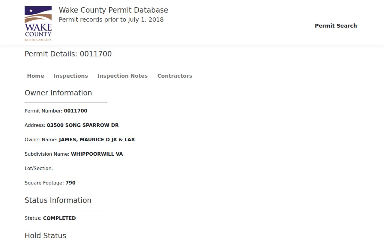
A result can include owner, address, subdivision, status, dates, applicant, value, water or sewer, zoning, PIN, map or block or lot, acreage, and plat reference. A permit still does not prove who lived at the address. It identifies a regulated project or applicant at a point in time, and a missing result can reflect a cutoff, changed address, changed PIN, different agency, or unindexed record.
Fuquay-Varina Previous Residents Place Labels
Older sources may use Piney Woods, Fuquay Springs, or Varina rather than the modern town name. Fuquay Springs incorporated in 1909, and Fuquay Springs and Varina joined as Fuquay-Varina in 1963. Search those labels alongside nearby cross streets, the spring or rail context, institutional names, lot or block terms, and the address’s legal description. The separate names can explain why a modern-name search misses a directory, deed, map, or newspaper pointer.
The official town history records the two-community origin and the 1963 merger.
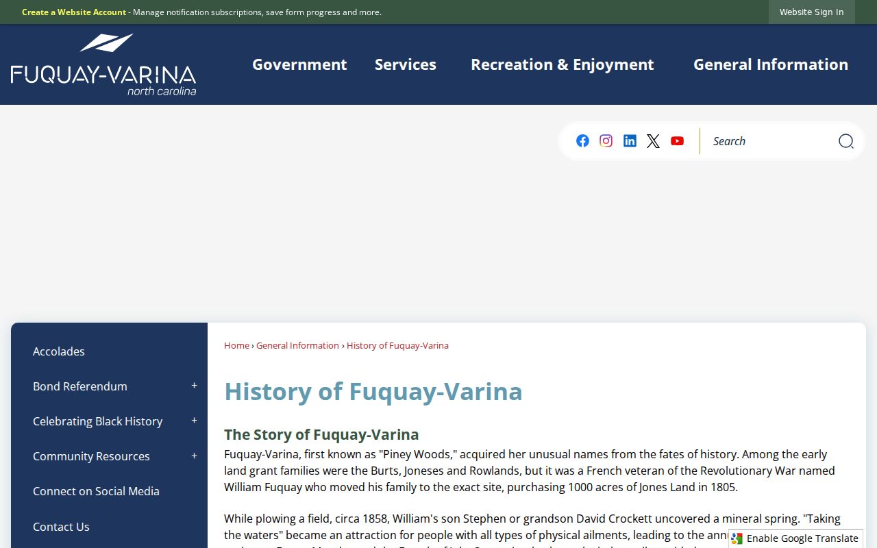
Historic place labels widen the search without inventing a number change. Keep the original label exactly as printed and connect it to a modern parcel only when the deed, map, street context, or another independent record supports that connection.
For pre-modern parcel context, Olivia Raney holds land-entry leads from 1778 to 1846, Guardians’ Accounts from 1817 to 1947, 1958 Wake Property Maps by Parcel in noncirculating map drawers, and News & Observer indexes for November 1926 through July 1953 and 1967 through 1976. Each source answers a different question. A land entry is not a deed, a guardians’ account is not proof of residence, and a newspaper index points to an article rather than supplying its full text.
Fuquay-Varina Previous Residents Historic Anchors
The Fuquay Springs Historic District is a useful address context for work near South Main Street, Fuquay Avenue, Spring Street, and Angier Road. The National Register record lists the district in 1996 and notes significant years including 1899, 1908, and 1909. Its boundaries and resource descriptions can help select maps, photographs, plats, tax material, and newspaper searches. They do not create a complete chain of previous residents for every building within or near the district.
The National Register historic-resource record is an address anchor for this earlier layer of research.
Use the resource name and the modern address as separate notes. Sanborn maps can add building footprints, street or house numbers, use notes, water features, and fire context, but the inspected sources did not verify any Fuquay-Varina edition years or a direct local sheet. Record the edition and sheet only after a source confirms them.
Fuquay-Varina Previous Residents Limits
Every previous-resident claim should state what the record proves and when. A recorded deed proves an instrument and named legal roles. A 1961 directory gives a historical printed snapshot. A census record is tied to an enumeration date and area. A permit identifies a project, applicant, or owner field when displayed. Preserve the source URL, date, page or recording reference, and uncertainty rather than presenting an old source as a current fact.
When a line ends online, continue through the Register of Deeds terminal or counter, Olivia Raney consultation, library catalog, historical society resources, State Archives finding aids, and the appropriate clerk for probate or court material. Do not publish sensitive identifiers, protected addresses, sealed or juvenile case information, certificate images, or unverified accusations. A careful household history leaves gaps visible instead of filling them with guesswork.
Lawful use. Previous-resident research in Fuquay-Varina is for house history, family history, and personal curiosity. Do not use an address trail to harass, track, threaten, or contact a living person.